Chartbook Maker (โปรแกรมสำหรับพิมพ์ชาร์ตทางทะเลแบบแสดงผลเต็ม)
ข้อมูลทั่วไป ก่อน ดาวน์โหลดโปรแกรม
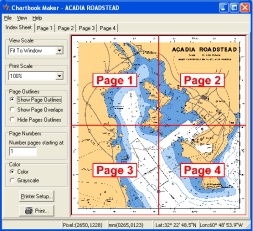
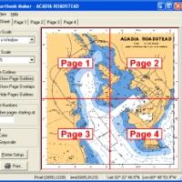
Chartbook Maker (โปรแกรมสำหรับพิมพ์ชาร์ตทางทะเลแบบแสดงผลเต็ม) : เป็นโปรแกรมสำหรับพิมพ์ชาร์ตทางทะเลแบบแสดงผลเต็มในรูปแบบสมุดได้ง่ายๆ โดยใช้เครื่องพิมพ์ปกติทั่วไปนี่แหละครับ โปรแกรมนี้สามารถที่จะสร้างหน้าในแบบเดียวกับสร้างสมุดแผนที่ถนนทั่วไปครับ ส่วนของแต่ละชาร์ต จะถูกพิมพ์เป็นแต่ละหน้าด้วยพร้อมทั้งตัวเลขอ้างอิงหน้าของส่วนถัดไป หน้าแรกจะเป็นสารบัญของชาร์ตทั้งหมดจะถูกพิมพ์ออกมา พร้อมทั้งเลขหน้าของแต่ละแผ่น....
Note : โปรแกรมนี้ มีคุณสมบัติเป็น Shareware นะครับ ทางผู้พัฒนา โปรแกรม (Program Developer) เขาได้ท่านได้นำไปใช้กันก่อน ในบาง ความสามารถ (Feature) ของโปรแกรม นะครับผม หาก ถ้าท่านต้องการจะใช้ต่อกันในแบบ ตัวเต็มๆ (Full Version) หรือ แบบไม่มี การจำกัดเวลา (No Time Limit) ละก็ ท่านจะต้อง เสียค่าลงทะเบียน (Register) เป็นเงินจำนวน $30.00 ครับ .. โดยท่านสามารถที่จะติดต่อกับทางผู้พัฒนา โปรแกรมนี้ได้ทาง E-Mail : Sales@Apocgraphy.com (ภาษาอังกฤษ) นะครับผม ...
English Descriptions : Chartbook Maker. Easily print full resolution marine charts in a handy booklet format using normal printer! It does this by creating tiles in the same way as map books do for street maps. A section of each chart is printed to a separate page with references to adjoining sections. At the start of the booklet an index of the full chart is printed along with the page numbers of the tiles. It reads all NOAA BSB format charts.
There are a number of times when a chart book is handy:
- Your boat is too small to conveniently unfold a full sized chart.
- You have electronic charts but don"t want your laptop to get wet.
- You want to keep all your charts in one easy to reference book.
- You have electronic charts but don"t have a full size plotter to print them out to scale.
- You like to write on your charts and don"t want to ruin your full sized charts.
- The software that came with your electronic charts sucks.
- General route planning and daydreaming.
 คำสำคัญ

โปรแกรมที่เกี่ยวข้อง !

ความคิดเห็น ()
ซอฟต์แวร์ไทย
Thai Software
ซอฟต์แวร์ฟรี
Freeware
ซอฟต์แวร์สามัญ
First AID
ซอฟต์แวร์แนะนำ
Recommended
สูงสุดในสัปดาห์
Top Download
สูงสุดตลอดกาล
Hall of Fame
Submit Software

 ซอฟต์แวร์
 แอปพลิเคชันบนมือถือ
 เช็คความเร็วเน็ต (Speedtest)
 เช็คไอพี (Check IP)
 เช็คเลขพัสดุ
 สุ่มออนไลน์
